
 Established division
Aerial Engineering & Geomatics
Turn the site into information you can use.
Vexonix AEG captures sites and buildings with RTK-positioned aircraft, then turns them into maps, 3D models, measurements and records — so planning, estimating and reporting start from what’s actually there.
- DJI Matrice 4E
- RTK positioning
- GeoTIFF · LAS/LAZ · OBJ
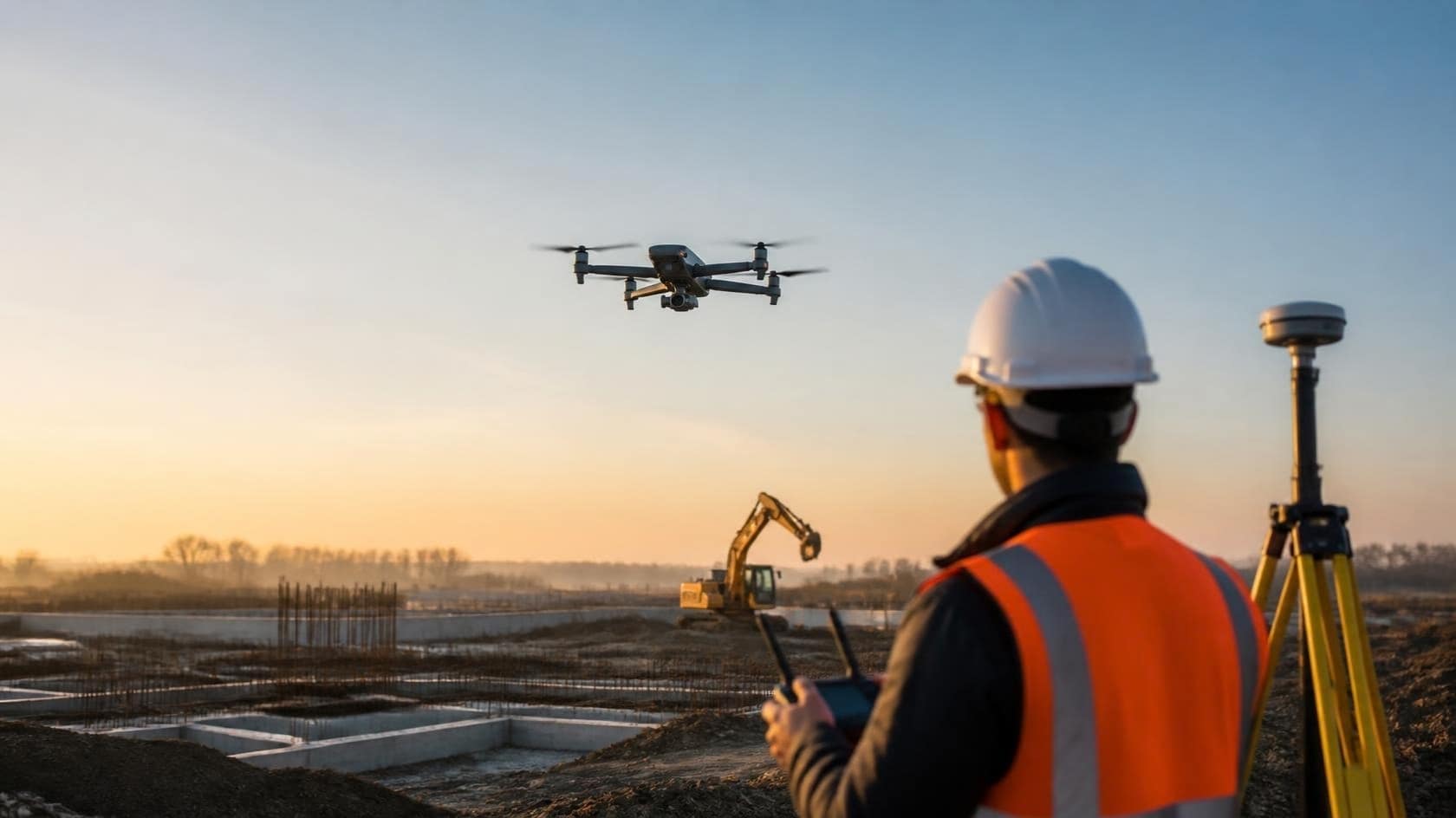
Illustration · commercial capture scene
From commercial site to usable record
A planned capture. A clear deliverable.
Follow the method from the first scope to the next comparison. The commercial scene is an illustration; the graphics explain the workflow and are not measured project data.
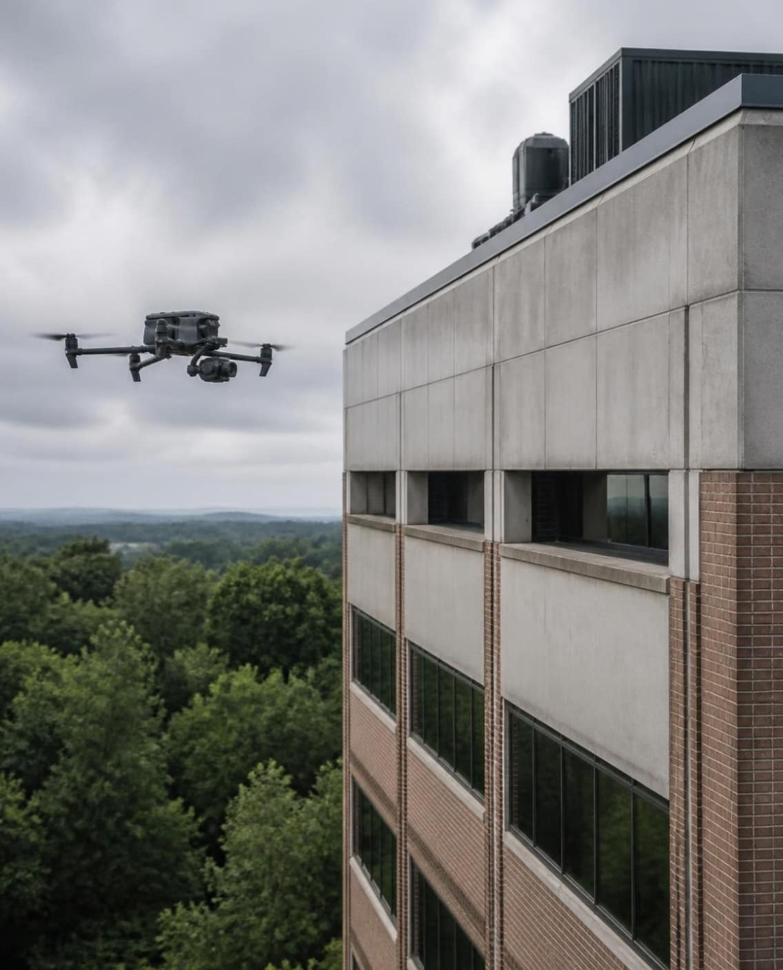
Illustration · commercial facade capture scene Start with the decision
A facade record, a construction milestone or a stockpile report begins with the areas and outputs your team needs. Access, airspace, capture grade and any accuracy requirement are agreed before fieldwork.
Method diagram · planned grid, not a logged flight Capture to a plan
The Matrice 4E captures overlapping imagery for mapping and models, with corrected image positions on RTK missions. Facade and detail records use the viewpoints the scope needs; ground and handheld capture cover accessible details where aerial work is unsuitable.
Method diagram · image alignment and map organization Align & verify
Photogrammetry matches shared features across overlapping images and estimates the camera positions. Maps are georeferenced; control and independent checkpoints are included where the agreed accuracy requires them. Visible observations are organized by location and elevation.
Method diagram · surface, points and measurement boundary Build the scoped outputs
Where the capture supports them, the aligned imagery produces an orthomosaic, dense point cloud, mesh or digital surface model. Stockpile and area measurements use defined boundaries and an agreed reference surface. A visual condition or milestone record can be delivered without a model.
Method diagram · delivery and repeat-visit records Document & compare
Dated images, located observations, reports and working files are delivered in the formats agreed at scoping. Repeat visits follow a consistent capture plan so the records can be compared. Your team receives a usable record with its scope and accuracy limits stated.
For a real processing reference, see the residential progress demonstration. It is labelled separately from this commercial workflow.
The intelligence layer
On its own, or inside the job.
AEG is how Vexonix understands a site. Sometimes that’s the whole engagement. Often, it’s the first step of another one.
- Capture
- Align
- Reconstruct
- Measure
- Document
- Compare

Standalone
Aggregates, construction and facility teams use AEG directly: stockpile volumes, progress records, condition baselines and site maps.
Plan an AEG capture
Inside AQUA
Aerial capture, where conditions allow, helps scope AQUA exterior-cleaning work. Clients can add an AEG existing-condition record of the building to keep.
How AQUA scopes a building
Inside AVIA
The same planned capture sits behind AVIA’s property and project media, so the story stays grounded in the real site.
About AVIA
Supports Aggregates · Construction · Facilities · AQUA scoping · Asset documentation
RTK positioning
RTK precision, built into the capture.
AEG flies the DJI Matrice 4E with RTK positioning. Real-time kinematic corrections — from a GNSS network service or a base station on site — refine the aircraft’s position while it flies, so each image is tagged with a corrected position rather than a standard GPS estimate.
Tighter geometry
Corrected image positions give the photogrammetry solve a stronger starting point, so maps and models line up with the site more closely.
Comparable visits
Repeat captures land on the same positional frame, so change between visits reflects the site — not drift in the data.
Less ground control
RTK reduces how many ground targets a site needs. Where a project calls for a stated accuracy, we still set ground control and independent checkpoints.
Accuracy is scoped, not assumed. We agree the accuracy a decision needs before we fly, plan RTK, ground control and checkpoints to match, and report how the result was checked. Vexonix deliverables are not legal land surveys.
Who it’s for
Site data for the teams that build, supply and own.
The difference between guessing and knowing — measured, dated and shareable.
- Aggregate yards & material sitesStockpile volumes, inventory snapshots, orthomosaics, site maps and reporting.
- Commercial builders & general contractorsProgress documentation, BIM/VDC coordination visuals, site records and owner reporting.
- Residential builders, pool contractors & landscapersProperty documentation, progress records, 3D models and before/after visuals for client presentations.
- Civil, infrastructure & industrial sitesAccess roads, laydown yards, corridors, earthworks and periodic site records.
- Property owners & asset managersCondition baselines, roof and exterior records, capital-project documentation and portfolio visibility — including existing-condition records alongside AQUA cleaning.
Outcomes
What changes when the site is measured.
Less uncertainty before work starts
Planning, estimating and scheduling start from measured site conditions, not assumptions.
Measured, not eyeballed
Stockpile volumes, areas and elevations measured on a 3D model — not paced out or guessed.
Change you can prove
Dated captures from consistent positions make change visible, comparable and reportable.
Files that fit your tools
GeoTIFF, LAS/LAZ, OBJ/PLY and PDF reports that open in the GIS, CAD and reporting software you already use.
Deliverables
Outputs your team can open, measure and share.
Formats are confirmed at scoping, so files drop straight into your GIS, CAD or reporting workflow.
Orthomosaic maps
High-resolution, georeferenced top-down maps for planning, reporting and project coordination.
GeoTIFF · JPG/PNG previews
3D mesh models
Detailed 3D surface reconstructions for visualization, design support and remote site review.
OBJ · PLY
Digital surface models
Elevation rasters of terrain and structures for grading review, drainage context and volume work.
GeoTIFF
Point clouds
Dense aerial point clouds for use in common geospatial and engineering platforms.
LAS · LAZ
Volumetric reports
Stockpile, cut and fill volume calculations delivered in clear, easy-to-read formats.
PDF report · measurement exports
Site progress records
Repeat captures from consistent positions that show visible change over time for owners and project teams.
Dated image sets · models per visit
Elevated asset imaging
Structured imagery packages of tower cranes, rooftops and elevated areas for planning and coordination.
Organized image sets
GIS-ready project layers
Deliverables organized as working layers so your team can open them in QGIS or similar tools.
GeoPackage · QGIS project
Core capabilities
- RTK-positioned capture. DJI Matrice 4E flights with real-time kinematic (RTK) corrections, so every image carries a corrected position — the basis for consistent, measurable outputs.
- Stockpile volumetric analysis. Volume data for aggregate operations, pits and material yards — supporting inventory tracking, production planning and reporting.
- Facade & property visual condition documentation. A dated visual record of the building’s exterior with located observations and a written report — a paid deliverable the owner keeps for maintenance planning, budgeting and future comparison. Visual documentation, not an inspection, certification, building-envelope assessment or legal survey.
- Construction & progress documentation. Scheduled progress records, milestone captures and pre-pour / under-slab visual records of what is visible from accessible positions before it is covered. Aerial where site and airspace allow, ground and handheld where they don’t. A visual record only: concealed conditions cannot be seen, and no engineering conclusions are implied.
- Photogrammetry & 3D modelling. 3D models and orthomosaics generated through photogrammetry workflows for site visualization, planning and analysis.
- Tower crane & elevated asset documentation. Structured aerial capture of elevated construction environments for coordination and site awareness.
Why Vexonix AEG
Engineered capture. Deliverables you can defend.
Engineered capture, not drone footage
Planned grids, documented settings and RTK positioning, flown to the capture grade agreed at scoping.
The right aircraft for measurement
The DJI Matrice 4E — a mapping and inspection platform with a multi-lens payload and RTK — is AEG’s technical workhorse.
Clearly labelled workflow
Commercial scenes are illustrations; method diagrams explain the workflow. A separately labelled residential demonstration provides a secondary processing reference.
Authorized operations
Flights under the Canadian Aviation Regulations, Part IX, led by a pilot with Transport Canada Advanced Operations certification; NAV CANADA authorization where the airspace requires it.
Processing reference
A separate demonstration of repeat capture.
The residential progress demonstration is a secondary processing reference, not a commercial project case study. Client work is published only with approval.
Capture grades
Choose the grade that fits the decision.
Every AEG project is scoped to one of three Vexonix capture grades, agreed before the flight.
Vexonix Red
Structured documentation
Systematic capture built for measurement, mapping and records you can compare over time.
Vexonix Black
Fast visual records
Quick-turn visual capture when the priority is a current, dated view of the site.
Vexonix Blue
Presentation-ready output
Polished outputs prepared for owners, stakeholders and client presentations.
Process
A clean workflow from field capture to practical documentation.
Built for repeatable site records — not one-off “nice drone footage.”
Scope the job
Define the site, risk controls, deliverables and operating constraints.
Plan the mission
Controlled-airspace checks, site hazards, flight route and capture strategy.
Capture the data
RTK-positioned drone imagery, manual detail capture where safe, and structured field logs.
Process & verify
Aerial triangulation, orthomosaics, 3D models, volume calculations, exports and QA review.
Deliver clearly
Reports, visuals and GeoTIFF / OBJ / PLY / LAZ files where required, with client viewing links.
Pilot projects
Start with one site.
See how aerial mapping, 3D modelling and site documentation support your project, yard or operation before committing to a program.
Paid pilot project
A low-risk first project that shows your team what aerial documentation, 3D modelling, mapping and visual reporting look like on one real site.
Best for
- Aggregate yards
- Construction sites
- Residential and pool projects
- Stockpile or material documentation
- Progress reports
Strategic sample pilot
A limited number of sites that are a strong fit for portfolio development may be offered at reduced or no cost, in exchange for permission to use sanitized, non-sensitive visuals.
Best for
- Construction
- Roofing and exterior
- Crane and elevated documentation
- Civil and laydown yards
Scope & accuracy
Vexonix provides aerial documentation, photogrammetry, visual records and decision-support deliverables. Unless specifically stated in writing and completed with the appropriate licensed professionals, Vexonix deliverables are not legal land surveys, engineering certifications, or substitutes for licensed inspection reports. Accuracy depends on flight altitude, RTK and ground-control setup, environmental conditions and site complexity; expectations for your site are agreed at scoping and, where a stated accuracy is required, checked against independent checkpoints.
FAQ
Questions project teams ask.
What industries does Vexonix AEG work with?
Primarily aggregates, construction and engineering teams that need accurate aerial documentation, volumetrics and project visualization — plus property owners and asset managers who need condition and progress records.
Do you operate in controlled airspace?
Yes, where authorized. Flights are led by a pilot holding a Transport Canada Advanced Operations certificate, and when a site is inside controlled airspace we obtain authorization from NAV CANADA before the flight. Airspace validation and safety checks are completed before deployment.
Are your deliverables suitable for engineering and GIS workflows?
Orthomosaics, 3D models, surface models, point clouds and volumetric reports are delivered in standard formats — GeoTIFF, OBJ, PLY, LAS/LAZ and PDF — that open in common GIS, CAD and engineering tools. We confirm formats and coordinate requirements at scoping.
Do you provide certified surveying services?
No. We are not land surveyors. We provide aerial data products that support planning, visualization and operational decisions. Unless specifically agreed in writing and completed with licensed professionals, deliverables are not legal land surveys, engineering certifications or inspection reports.
Do you use RTK positioning?
Yes. AEG flies the DJI Matrice 4E with RTK corrections, so each image is tagged with a corrected position. RTK tightens the geometry of maps and models and reduces the ground control a site needs. When a project requires a stated accuracy, we add ground control and independent checkpoints and report how the result was checked.
How accurate are your volumetric calculations?
Accuracy depends on flight altitude, RTK and ground-control setup, environmental conditions and site complexity. We follow structured capture standards so that measurements are consistent and repeatable, and we agree accuracy expectations for your site before we fly.
How do you deliver the final files?
Through private links and organized file packages, documented and ready to use in your existing workflows.
How quickly can a project be completed?
Turnaround depends on site size and the deliverables required. Standard captures are typically processed within a few business days after data capture; we confirm timing at scoping.
Do you need site access or support personnel?
Site access must be granted before operations. A designated site contact is recommended but not always required.
Can you provide recurring documentation for long-term projects?
Yes. Recurring capture can be scheduled monthly, quarterly or by milestone for construction progress, stockpile management and portfolio records.
Can AEG documentation be added to an AQUA cleaning job?
Yes. The AQUA assessment is used to price the cleaning and isn’t delivered as documentation. If you also want a record of the building to keep — imagery, mapped areas and elevation documentation, with orthomosaic or 3D where suitable — AEG quotes it separately as an existing-condition package.
What safety procedures do you follow?
Every mission includes pre-flight checks, obstacle and hazard assessment, airspace validation and weather monitoring, under the Canadian Aviation Regulations for remotely piloted aircraft. See our Safety & Compliance page for details.
Tell us about the site.
Tell us about the site and the decision the data needs to support. We’ll recommend the capture, positioning and deliverables — whether AEG is the whole job or the first step of one.